I still remember opening the manila envelope. Large enough to contain a vintage copy of Rolling Stone Magazine, its contents to me were even more exciting: a stack of National Park brochures postmarked from Alaska! Though they felt stiff and official, the unfolded brochures offered a distinct portrayal of Alaska’s great parks, and as I admired each photo and studied each narrative, I began to layer the pictures and text onto what had heretofore only been my Alaska imagination. The result was an Alaska inspiration, and I was suddenly rapt in the process of planning my first Alaska wilderness trip.
Later that September of 1992, my great friend Jeff Sallan and I were standing on a beach on Telaquana Lake within the wilderness of Alaska’s incomparable Lake Clark National Park. After years of Sierra Nevada backpacking trips and months of trip planning and preparation, we were now deep in the Alaska bush, and both elated and terrified by the sight and sound of our float plane disappearing over the horizon to the south. Armed with a can of bear spray, a compass, the necessary topographic maps, a couple of fishing rods, and plenty of ignorance, we shouldered our 60 lb loads and began our southbound journey to Twin Lakes with a steep alder-choked climb out of Telaquana Lake.
For the next 10-days we methodically made our way through snow, sleet, and freezing temps to upper Twin Lake, completely oblivious to the fact that we were marching through one of the coldest and snowiest Septembers ever recorded in Alaska; that Chris McCandless was lying dead in a bus a couple hundred miles away, and that Mt. Spur was erupting in the park just to our east. Notwithstanding the daily hand-numbing misery of stuffing a wet & frozen tent into its stuff sack, we loved every minute of our expedition. Not only did our amazing adventure set the hook for my permanent move to Alaska a couple years later, it taught me the importance of planning a wilderness trip, the sense of accomplishment of a successful expedition, and the amazing euphoria of spending more than a week totally immersed in the Alaska Wild.
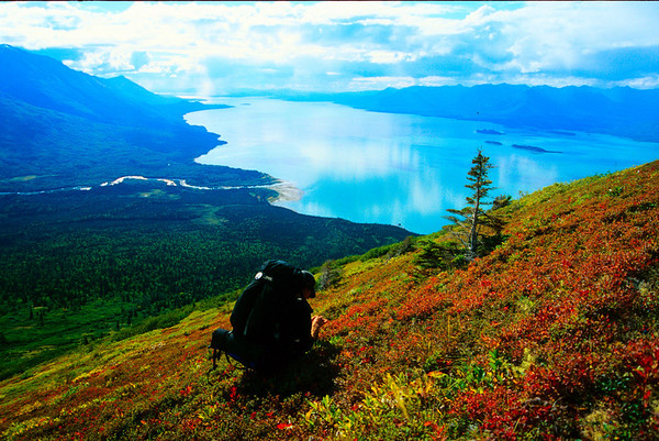
DEREK NELSON TAKES A PAUSE FOR BLUEBERRIES HIGH ABOVE LAKE CLARK: CIRCA 1998. ©DAN OBERLATZ
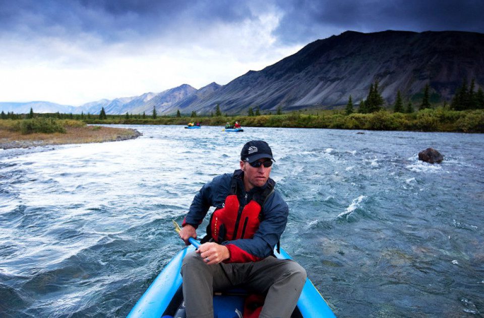
Since that first trip, I’ve spend the past 20 years leading and guiding dozens of expeditions through our amazing state’s most remote wilderness regions. From winter ice climbing, skiing, and mountaineering expeditions to summer backpacking, rafting, and kayaking trips, I’ve been super fortunate to have safely experienced Alaska’s true essence. While the imagination phase of planning a trip has evolved beyond snail-mailed information packets spread out on the kitchen table and replaced by the power of the internet, the basic steps of planning a backpacking expedition to Alaska remain largely the same. The first of those steps is choosing a destination and a planning your route.
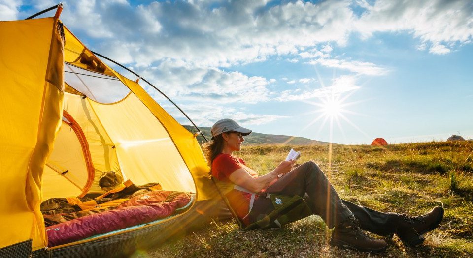
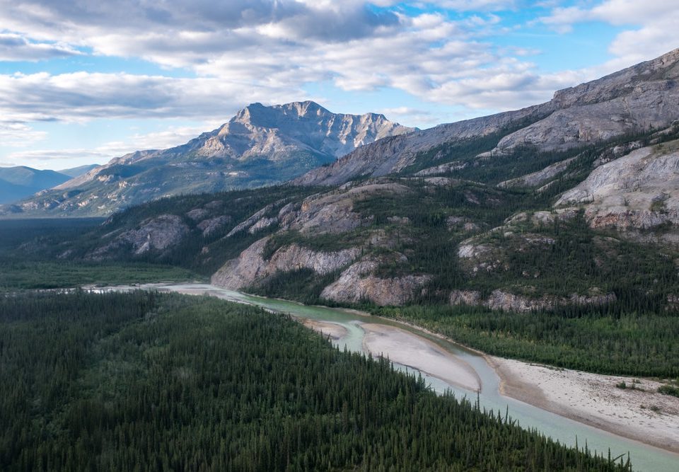
It’s been said that Alaska has two seasons: winter and construction season! Construction season happens to coincide with our short but wonderful summer, and the best time of year for backpacking in Alaska. The endless daylight, abundant wildlife, the explosion of wildflowers, and otherworldly majesty, puts Alaska right up there as one of the greatest adventure destinations on the planet. That said, there are seasons within the summer season, and understanding the optimal times to visit specific national parks within Alaska is key to planning a successful trip. For our 1992 trip, Jeff and I had settled on the obscure Lake Clark National Park due to its latitude and location in the southern part of mainland Alaska. Because Lake Clark straddles the Alaska & Aleutian Ranges, its geography provides visitors with a rain soaked coastline, a heavily glaciated eastern escarpment, and an arid west side that sits in the rain-shadow of the divide. The west side of the park offers some of the best tundra hiking in Alaska, and the backpacking there can be good from late May through the month of September: an iffy, if not wintery month in other parts of the state.
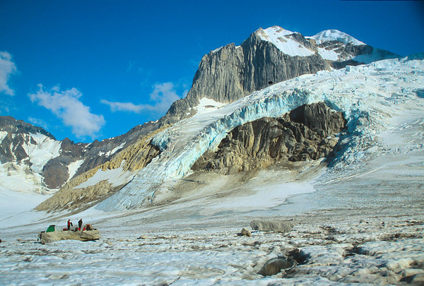
MARK STEVENS, MALCOLM CASON, & DEREK NELSON ENJOYING A FLAT STONE ON A BIG ICE CUBE IN THE NEACOLA MOUNTAINS: LAKE CLARK NATIONAL PARK. ©DAN OBERLATZ
Today, with the multitude of seasonal climate & weather resources, trip reports, and forums immediately accessible online, it’s much easier to choose the right trip combined with the right destination within Alaska. Factors to consider should be based on type of backpacking trip you’re planning and could include elevation, tides, latitude, bugs, firn line on the glaciers, river levels, snowline, optimal fishing, vegetation, and average temperature and precipitation. So do your homework before choosing your venue for a backpacking trip in Alaska, and always remember that some individual parks in Alaska may be bigger than the state you live in! This place is BIG. Listed below are my 2 favorite parks to backpack during each month from June through September:
June: Lake Clark National Park, Arctic National Wildlife Refuge
July: Katmai National Park, Wrangell-St. Elias National Park
August: Gates of the Arctic National Park, Denali National Park
September: Lake Clark National Park, Katmai National Park
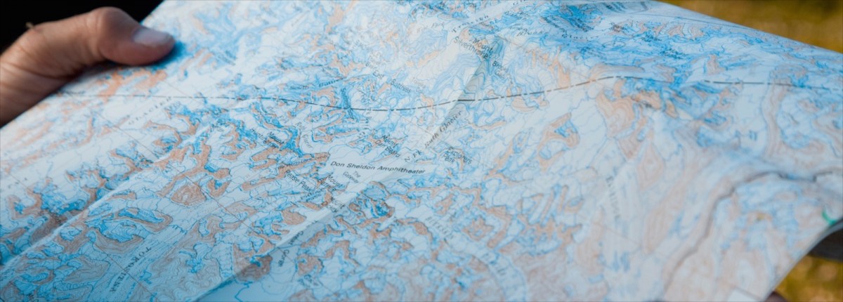
On that first trip to Lake Clark, Jeff and I sat down with an NPS Ranger before our bush flight to Telaquana Lake to discuss the route. She pointed out specific areas of interest on the topo maps, which we quickly marked with a pencil, but the orientation felt hurried and incomplete. Today, with the magic of Google Earth, and online trip planning tools like hillmap.com, choosing a route is much easier done from a computer and one can virtually explore the planet from the couch. But as I’ve said before, the maps hide the misery, and the internet has caused more than many to bite off bigger bites of Alaska than are chewable.
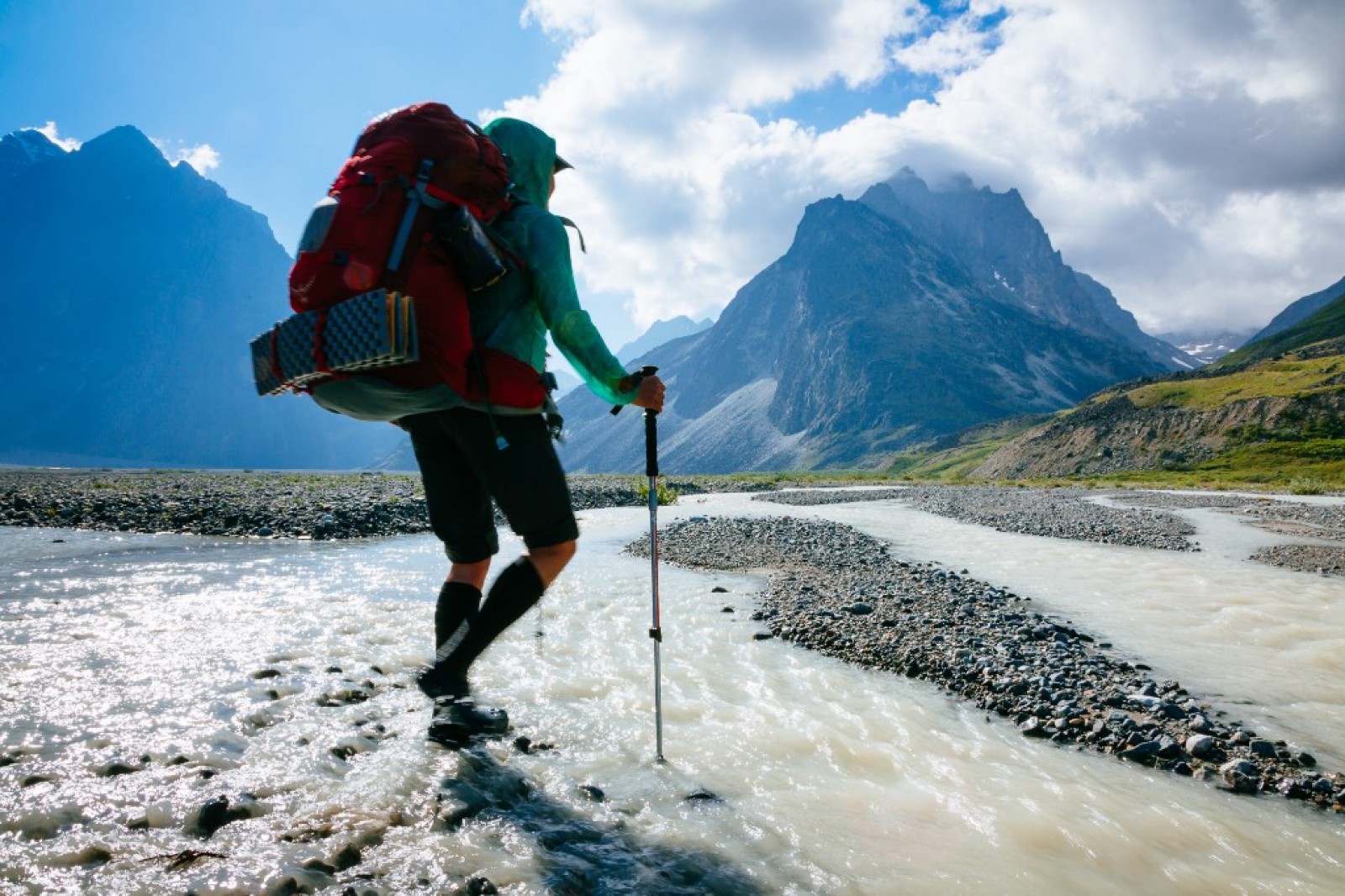
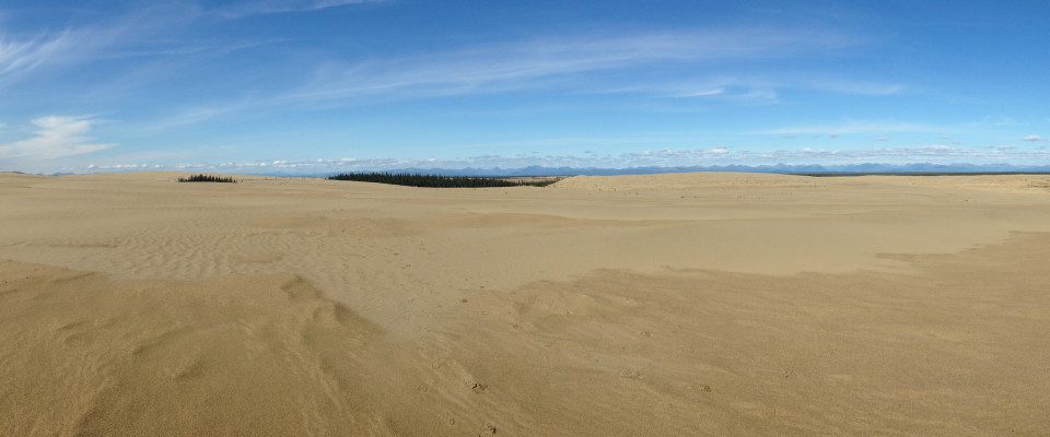
Now that you’ve chosen your destination in Alaska, and you’re planning your backpacking route, here’s some hard earned wisdom to consider. Keep a 7-mile/day pace in mind. If you see green on a map (your planning goal should be to avoid it), be prepared to cut that pace in half or more when you’re in “the big green.” As a general rule across Alaska, elevations between 3000’-5000+’ offer the best travel on foot. Build in 2 layover days into your itinerary for weather delays or exploration. Water, not a bear, is Alaska’s most dangerous threat to life and limb, so if you can, plan your trip to avoid glacially fed river crossings. If you have to cross a glacially fed river, seek out the braids or cross the glacier itself to get to the other side. All Alaska rivers & creeks accumulate water as they flow down gradient, so crossing higher in a watershed is most often easier than further downstream. Remember, most of the 15’ quads (Alaska’s most detailed maps) are more than 30 years old. In some cases, glaciers on a 1954 map are 300’ higher than present day, and “the big green” reaches higher into drainages and further up into the alpine; both due to climate change. With that in mind, don’t forget that south facing slopes will hold more dense vegetation and at higher elevations than will equivalent north facing slopes. Furthermore, remember the contour interval on these maps is 100’, and a 30-foot cliff can easily put you off route. In your pre-trip planning (and this is critical), consider which side of any creek or river you should be on over the course of your entire route. If you embrace these tips, plan ahead, and go into your trip with an open mind, you’ll find that there’s always a way around any obstacle in Alaska. And because it’s worth repeating, understand that there will be times on your trip where you realize that the maps hide the misery!
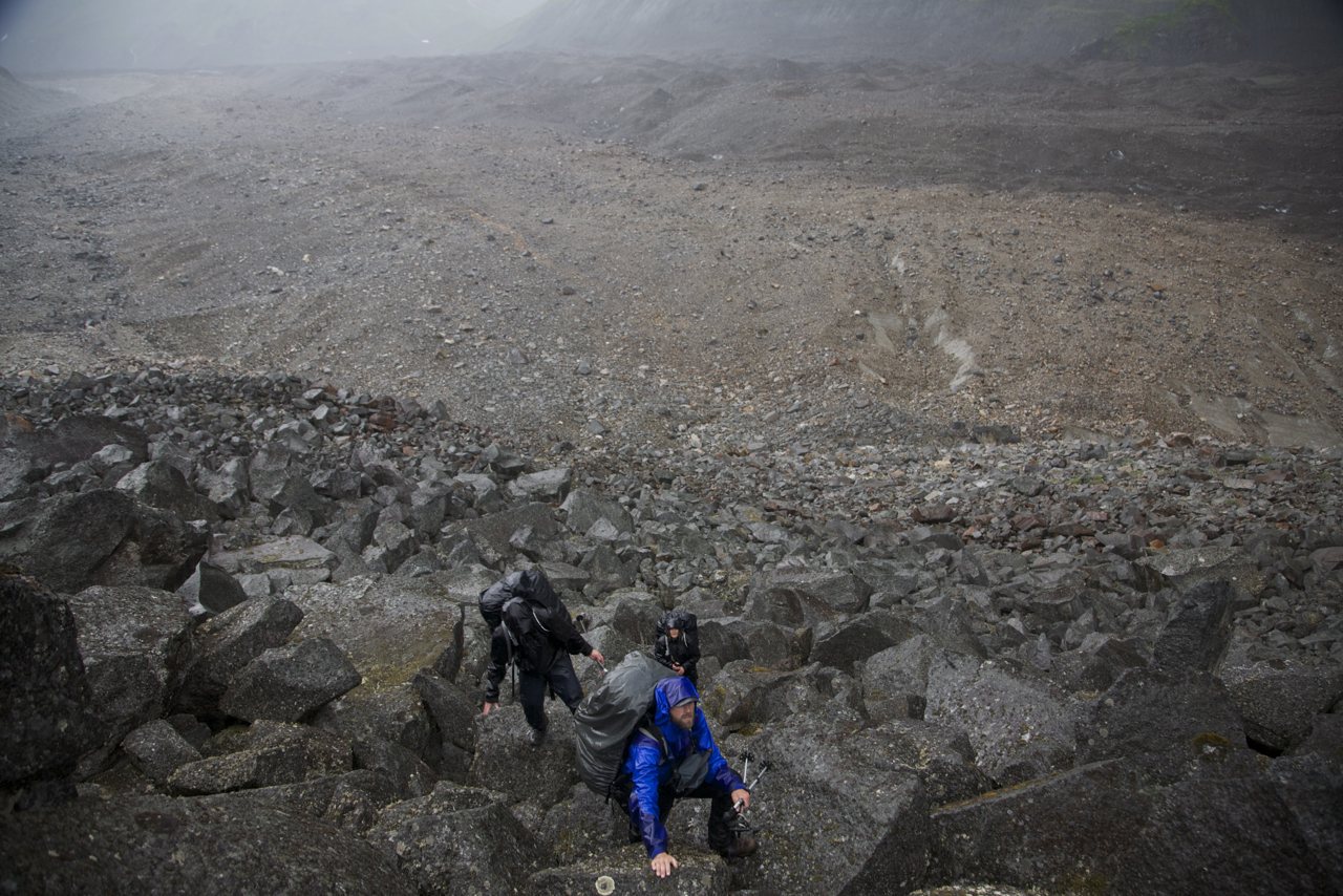
GUIDE AARON FETTER AND MARK & JOAN STROBEL ENJOYING A MAP INCONSISTENCY ABOVE THE KANIKULA GLACIER: DENALI NATIONAL PARK. ©DAN OBERLATZ
Now that you have your destination and your route dialed in, you can begin to focus on the specific details necessary to pull your backpacking adventure off in style. Stay tuned to this blog as we continue through the recommended steps!
Related from Alaska Alpine Adventures: Guided Alaska backpacking trips · Explore our destinations · Walk in the Footsteps of a Wilderness Legend